قسم الهندسة الجيولوجية

المزيد ...

حول قسم الهندسة الجيولوجية

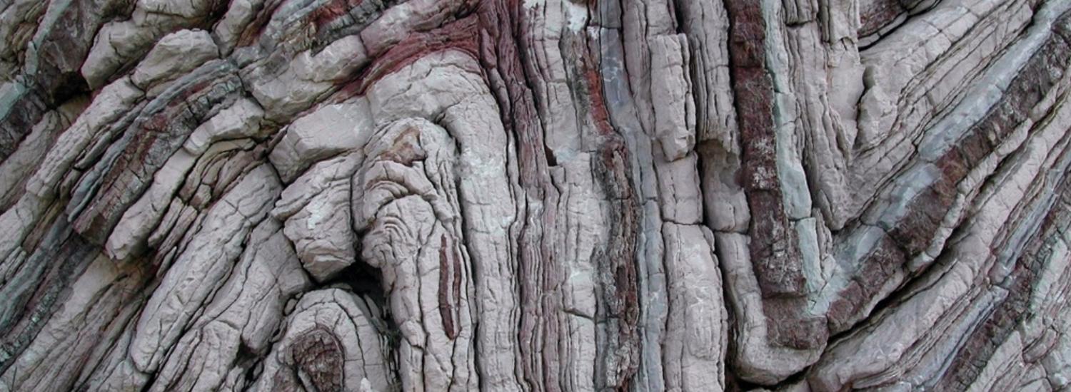
أنشئ قسم الهندسة الجيولوجية كقسم من أقسام كلية الهندسة سنة 1972م بهدف بناء الكوادر المؤهلة للقيام بمهام التقييم والتصميم الهندسي المتعلق بالمصادر الطبيعية مثل المياه الجوفية والنفط والثروات المعدنية وكذلك الأعمال الجيوهندسية والجيوتقنية، والقيام بالبحوث والدراسات في هذه المجالات التي تعتبر قياسا من أهم المجالات التي تؤثر اقتصادياً واجتماعياً، كمن يضطلع بتقديم المشورة الفنية والهندسية حول المشاكل ذات العلاقة بالتطبيقات الجيولوجية الهندسية. ويضم القسم أربع شعب هي الموارد المائية وشعبة الهندسة البتروفيزيائية وشعبة الثروات المعدنية وشعبة الهندسة الجيوتقنية. ويتولى تسيير البرنامج العلمي والبحثي بالقسم أكثر من 18 عضو هيئة تدريس في تخصصات مختلفة الذين يقومون بالعملية التعليمية وإعداد الدراسات والبحوث في مختلف اختصاصات القسم يساعدهم في ذلك مجموعة من المهندسين والفنيين المؤهلين تأهيلا عاليا في أعطاء التمارين والمساعدة في المختبرات.

يضم قسم الهندسة الجيولوجية أربعة شعب، وهي الموارد المائية، البتروفيزياء، والموارد المعدنية ، والهندسة الجيوتقنية وهي:

شعبة الموارد المائية:

تعني شعبة الموارد المائية بدراسة الأحواض المائية الجوفية بأنواعها ونمذجتها والتنبؤ بقدراتها الإنتاجية ودراسة خواصها الجيوكيميائية وتقييم صلاحيتها للاستعمالات المختلفة وإدارتها، كما تهتم بدراسات تصميم حقول الآبار بناءا على قدرات الخزانات الجوفية للمحافظة على إنتاجية أمنة واقتصادية كما تعطي الشعبة اهتماما خاصا بتصميم وحفر أبار المياه وتنميتها وصيانتها وتصميم قدرة مضخات المياه، وتهتم هذه الشعبة أيضاً بدراسة تلوث المياه الجوفية ومسبباته وانتقال الملوثات ومعالجتها.

شعبة البتروفيزياء:

تختص هذه الشعبة بدراسة الأحواض الجيولوجية وخواصها المختلفة وذلك لتقييم إمكانياتها من المصادر النفطية والغازية وكذلك دراسة الخواص والبتروفيزيائية للمكامن النفطية المختلفة في الصخور بجميع أنواعها باستخدام بيانات الحفر وتحاليل السرود البئرية وتحليل العينات اللبية، وتعطي اهتماما خاصا لتحاليل سرود الآبار المفتوحة والمغلفة وكذلك اختبارات وتحاليل العينات اللبية الروتينية والخاصة حيث يشكل كليهما أسس تحليل الأحواض والمكامن النفطية وكذلك دراسة المشاكل الجيولوجية والبتروفيزيائية المؤثرة في عمليات الإنتاج وفي طرق الاسترداد الإضافي المختلفة.

شعبة الثروات المعدنية:

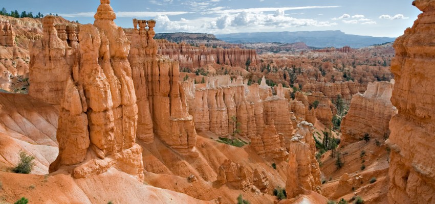
تهتم هذه الشعبة بدراسة وتقييم الخامات الفلزية واللافلزية، كما تهتم بدراسة الصخور الصناعية وعمليات البحث عن الثروات المعدنية باستخدام مختلف طرق الاستكشاف والتنقيب المعدني والجيوكيميائي، كما تهتم اهتماما خاصا بالدراسات الجيولوجية والبتروجرافية والمعدنية وأسس التقدير الاقتصادي لاحتياطيات الخامات المعدنية ودراسة جدواها الاقتصادية، كما ان هذه الشعبة تشكل رديفا أساسياً لهندسة التعدين حيث إن دراسة شكل وجيومترية أجسام الخامات تشكل الأساس لطرق التعدين المختلفة بما فيها السطحية والتحت سطحية.  وتهتم هذه الشعبة بدراسة المعادن والطينات وتقييم مدى صلاحيتها للصناعة.

شعبة الهندسة الجيوتقنية:

          تهتم شعبة الهندسة الجيوتقنية بكل التطبيقات الجيوهندسية في ميكانيكا التربة وميكانيكا الصخور بناء على الاختبارات المعملية والحقلية حيث يتم دراسة الترب والكتل الصخرية وطرق تصنيفها ودراسة المشاكل الجيوتقنية و أسس الطرق والإنشاءات ودراسة وتقييم الصخور والكتل الصخرية في مواقع السدود وتصميم التدعيم والحقن ودراسة وتقييم مشاكل الترسيب في الخزانات ووسائل الحد منها. و الدراسات الجيوتقنية للشواطئ والمواني وتقييم تأثير المد والجزر، كما تهتم هذه الشعبة بتصميم الأنفاق والغرف تحت الأرضية والحفر الرأسية وطرق التدعيم اللازمة، وتهتم بدراسة وتصميم منحدرات التربة والمنحدرات الصخرية وطرق حمايتها ودراسة مشاكل الانجراف وسبل الحد منها، كما تهتم بدراسة الأساسات ومشاكل الانهيارات والهبوط، كما تهتم اهتماما خاصا باستخدام الطرق الجيوفيزيائية في التصميم الجيوتقني. 

حقائق حول قسم الهندسة الجيولوجية

نفتخر بما نقدمه للمجتمع والعالم

10

المنشورات العلمية

15

هيئة التدريس

437

الطلبة

0

الخريجون

البرامج الدراسية

بكالوريوس هندسة جيولوجية
تخصص الهندسة الجيولوجية

يحتوي البرنامج الدراسي على 152 وحدة دراسية وتنقسم المقررات الدراسية الى مقررات اجبارية ومقررات جامعية مقررات اختيارية ...

التفاصيل
ماجستير هندسة جيولوجية
تخصص الهندسة الجيولوجية

...

التفاصيل

من يعمل بـقسم الهندسة الجيولوجية

يوجد بـقسم الهندسة الجيولوجية أكثر من 15 عضو هيئة تدريس

staff photo

أ. صلاح الناصر خليفة أحمد

أ. صلاح الناصر أحمد تحصل علي درجة البكالوريوس في الهندسة الجيوتقنية من جامعة طرابلس, ليبيا ,سنة 2010, وتحصل على درجة الماجستير في مجال الهندسة الإنشائية من جامعة كيبيك, مونتريال, كندا, سنة 2017. حاليا هو محاضر مساعد بقسم الهندسة الجيولوجية, كلية الهندسة, جامعة طرابلس. تشمل اهتماماته البحثية ، استقرار المنحدرات ، الأساسات الضحله ، استخدام Matlab في مشاكل الهندسة الجيوتقنية ، تطبيق Python في الهندسة الجيوتقنية ، وتحليل العناصر المحدودة في الهندسة الجيوتقنية.

منشورات مختارة

بعض المنشورات التي تم نشرها في قسم الهندسة الجيولوجية

Lithology Investigation of Shaly Sand Reservoir by using Wire Line Data," Nubian Sandstone" SE Sirt Basin

dentify the rock lithology has important meaning for estimating the reserve of petroleum as reservoir capacity and storage ability. The lithology identification from well log based on not conventional cross plot proposed and studied, which is more easier instead of rock core data observation results. However, this work carried out comparison between chart and analytical solution of matrix parameter (ρma and ΔTma) estimation values of producer shaly sand reservoir, and present the main depositional environment affects. In addition to influences of pyrite, ferruginous encrustations, organic material throughout this studied reservoir. Consequently, variety of matrix parameters values is contributed by clay minerals present in this reservoir type. This study based on wire line data measured over than 750 feet produced Upper Nubian Sandstone belong to two oil fields, SE Sirt Basin. This shaly reservoir divided into three main units (R, E and F), and each unit has been subdivided into three subunits (F3, F2, F1, E3, E2, E1, R3, R2 and R1) from bottom to top according to depositional and petrophysical properties.
Bahia Muftah Ben Ghawar(12-2016)
Publisher's website

Determining Reservoir Quality by Combined Stratigraphic, Petrographic and Petrophysical Methods; Sahel and Essomoud Fields, Sirt Basin

Abstract This study covers the Fields producting from the Gialo Formation a reservoir which is composed of Limestone and Dolomitic-Limestone and consists mainly of highly altered Nummulitic Packstone. This study was achieved through three parts of study including a petrographic study, petrophysical study of reservoir properties from core analysis and borehole logs. The general geological framework was obtained from petrographical study of thirty six thin sections, 129 representative core plug data and logs from 5 different wells are utilized to better understanding the petrophysical framework of the formation. The plots correlating petrophsical parameters and the frequency histograms suggested the presence of distinctive reservoir trends. These discriminations were also represented in Winland porosity- permeability cross plots resulted in clusters for different port-size that are responsible for different flow characteristics. Linear and multiple regression were used for the study of each unit. The permeability models were constructed and their reliabilies were compared by the regression coefficients for predictions in un-cored well. The combination of all data revealed the worst ranked reservoir quality corresponded to moldic and intergranular pore types, which occurred mainly in the Bioclastic Wackstone facies. The highest ranked reservoir quality corresponded to intragranular and intergranular which occurred mainly in the Nummulitic Packstone Facies.
وردة الشوشان (2010)
Publisher's website

Classification, Enhancement And Stability Of Backfill And Embankment Case Study: Tajoura – Misurata

Abstract Normally the study and investigated of earth material from the view of their uses as embankment and backfill material has a great importance in earth woks. This research concerns the assessment of earth masses and their properties which related embankment and backfill suitability as well as providing a mixing methods to upgrade the unsuitable within the accepted standards. The objectives of this research could be briefed by the investigation of earth masses along the study area which is governed by the distribution of superficial deposits comprehensive laboratory testing of soil samples molding Andes properties classification testing proctor and California bearing ratio recognition of suit able and non suit able backfill soil enhancement of unsuitable soil by mixing with other suitable soil such as quarry dust provided by nearby quarry correlation analysis and economic feasibility the study area is located in east of Tripoli from Tajoura to Misurata . This study manly concluded that as long as the poorly graded soil (A3) is difficult to be compacted according to the engineering properties of such soil are enhanced certainly by mixing with good sailable materials such as quarry dust. This research also conduced that the compaction properties will be enhanced by mixing where the optimum moister content is needed at the increase of maximum dry density. This research provides procedure of mixing design and recommendations for the mixing to achieve better results.
عبد السلام محمد بحرون (2011)
Publisher's website