كلية تقنية المعلومات

المزيد ...

حول كلية تقنية المعلومات

تعد كلية تقنية المعلومات من أحدث كليات جامعة طرابلس حيث أنشئت بموجب قرار اللجنة الشعبية العامة للتعليم العالي سابقاً رقم 535 لسنة 2007م بشأن استحداث كليات تقنيات المعلومات بالجامعات الأساسية في ليبيا.

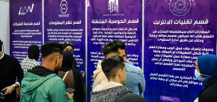
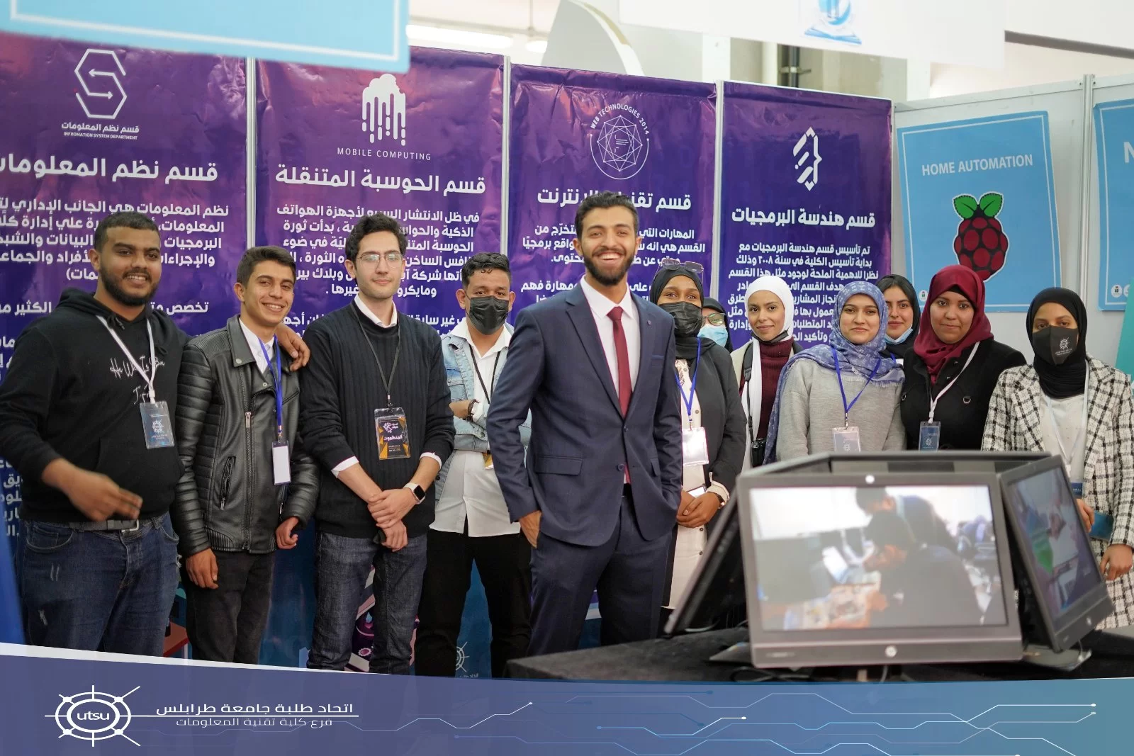
تكونت الكلية عند إنشائها من ثلاثة أقسام هي: قسم شبكات الحاسوب، قسم علوم الحاسوب وقسم هندسة البرمجيات والآن تشتمل على خمسة أقسام هي: قسم الحوسبة المتنقلة، قسم شبكات الحاسوب، قسم تقنيات الانترنت، قسم نظم المعلومات وقسم هندسة البرمجيات.

يتبع نظام الدراسة بالكلية نظام الفصل المفتوح ويضم كل عام دراسي فصلين دراسيين خريف وربيع وقد بدأت الكلية بقبول الطلاب والتدريس فعلياً مع بداية فصل الخريف 2008م. وتمنح الكلية درجة الإجازة المتخصصة (الجامعية) في تقنية المعلومات في أي من التخصصات سالفة الذكر. والحصول على الدرجة يتطلب إنجاز 135 وحدة دراسية على الأقل بنجاح. اللغة العربية هي لغة الدراسة بالكلية ويجوز استخدام اللغة الإنجليزية إلى جانبها. أما مدة الدراسة بالكلية فهي ثـمانية فصول دراسية.

تطمح الكلية إلى افتتاح برامج دراسات عليا بقسمي شبكات الحاسوب وهندسة البرمجيات مع بداية فصل الربيع 2018م.

حقائق حول كلية تقنية المعلومات

نفتخر بما نقدمه للمجتمع والعالم

69

المنشورات العلمية

38

هيئة التدريس

1710

الطلبة

159

الخريجون

البرامج الدراسية

بكالوريوس في تقنية المعلومات
تخصص هندسة البرمجيات

يهدف البرنامج الى إعداد الكوادر القادرة على إداء انجاز المشاريع البرمجية بالطرق الهندسية...

التفاصيل
بكالوريوس في تقنية المعلومات
تخصص الحوسبة المتنقلة

...

التفاصيل
بكالوريوس نظم المعلومات
تخصص نظم المعلومات

يهتم قسم نظم المعلومات بكيفية استخدام تكنولوجيا المعلومات وممارستها وتطبيقها في...

التفاصيل

من يعمل بـكلية تقنية المعلومات

يوجد بـكلية تقنية المعلومات أكثر من 38 عضو هيئة تدريس

staff photo

د. عبدالمنعم عمر احمد الاسود

عبدالمنعم الاسود هو احد اعضاء هيئة التدريس بقسم هندسة البرمجيات بكلية تقنية المعلومات. يعمل السيد عبدالمنعم الاسود بجامعة طرابلس كـاستاذ مشارك منذ 2010-02-27 وله العديد من المنشورات العلمية في مجال تخصصه

منشورات مختارة

بعض المنشورات التي تم نشرها في كلية تقنية المعلومات

Evaluating the Impact of Routing on QoS of VoIP over MANET Wireless Networks

In this paper, a performance analysis study for VoIP over mobile wireless ad hoc networks (MANET) is carried out using OPNET tool. The AODV, DSR, TORA, OLSR, and GRP routing protocols have been used as candidates to evaluate the impact of routing on quality of service (QoS) of VoIP application over MANET networks. Three different queuing mechanisms (FIFO, PQ, and WFQ) have been used also as nominee of queuing techniques. The VoIP is applied and the QoS is measured in terms of jitter delay, end-to-end packet delay, and wireless LAN media access delay and wireless throughput of 802.11 g technology with 54 Mbps
Azeddien M. Sllame(1-2022)
Publisher's website

Multiprotocol Label Switching

Multi Protocol Label Switching (MPLS) is a core networking technology that operates essentially in between Layers 2 and 3 of the OSI model; for this reason, MPLS has been referred to as operating at Layer 2.5. MPLS can overlay existing technologies such as Asynchronous Transfer Mode (ATM) or Frame Relay, or it can operate in an entirely IP native environment; this can allow users to take advantage of existing Customer Premises Equipment (CPE) while making a move towards converging all network traffic, such as data, video and voice, at a pace that users can accommodate and afford. MPLS provides. its users a number of advantageous features such as traffic engineering, network convergence, failure protection, and the ability to guarantee Quality of Service (QoS) over IP. arabic 2 English 27
Mariam Abojela Msaad, Amer R. Zerek , Wesam M. Tohamei(1-2012)
Publisher's website

Extracting Geographic 3D Integral Images Data from Raster Maps

Holoscopic 3D imaging (H3D) technology also known as integral imaging is a true 3D imaging technology. It offers the simplest form that is capable of recording and replaying the true light field 3D scene in the form of a planar intensity distribution, by employing Microlens array. Despite it uses the same characteristics of holographic, it records the 3D information in 2D form and display in full 3D with optical component, without the need of coherent light source and confine dark fine. In addition, it facilitates postproduction processing such as refocusing. This makes it more practical approach for real-time 3D image capture and display. In this paper, a new method of extract 3D integral images data from raster maps. The R2V is an advanced raster to vector conversion software system is mainly used in order to generate geographical 3D integral images. Experimental results are extremely satisfactory and for the first time it is proved that, Geographic 3D Integral Images is generated. It means that, a new certain approach enables GIS applications of using 3D integral images is now established.
Dr. Mahmoud Geat Eljadid(12-2021)
Publisher's website